
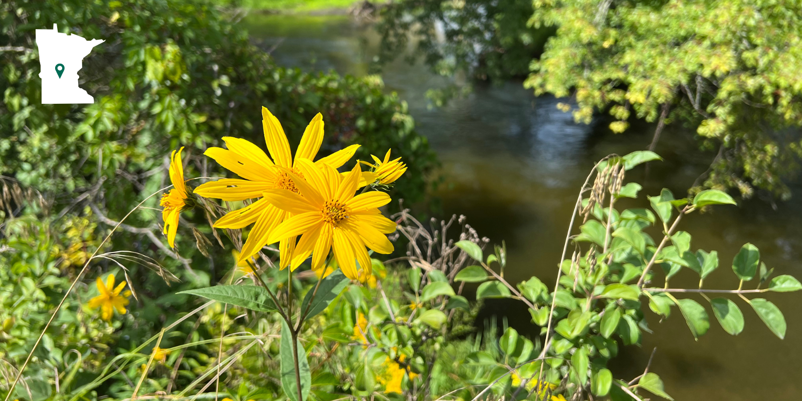
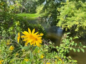
The Heurungs have protected over 70 acres of their property in Stearns County, mostly composed of forest and woodland, grassland, and wetlands, and 2,829 feet of shoreline that includes a portion of the Sauk River and a restored pond.
Active stewards of their land since they acquired it in 2017, the family partnered with Stearns County Soil and Water Conservation District (SWCD) and the Nature Conservancy to restore a large wetland habitat. Manoomin (wild rice), which was once prevalent in the Sauk River Watershed but has now largely disappeared, was seeded in the restored wetland portion of their property in 2021 and is now starting to establish.
The Heurungs made the wise and generous decision to place this property into a conservation easement to permanently protect the natural habitat, preserving its ability to perform critical environmental services for the region, like water filtering and providing important wildlife habitat in an area that is experiencing significant population growth and residential expansion.
They’re also looking out for future generations, “We wanted to make sure future generations had a natural space to enjoy, to hunt or fish. It’s so important to think of young people and leave them land that is natural. We saw this as a great opportunity to leave a positive legacy.”
Conserve More of the Sauk River Region
Make a donation today! Your gift helps amplify our protection and restoration impact across Minnesota.
Want to protect your property? Learn more about opportunities in the Sauk River Watershed region.
Wetlands to Row Crop Fields…
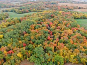
The west-central region of Minnesota, where the Minnesota Land Trust’s Alexandria Moraine and Mississippi Corridor North priority conservation areas are located, was once covered in tallgrass prairie as far as the eye could see. The prairie was interspersed with areas of wet prairie along with moraines, wetlands, and lake plains left behind after the retreat of the last glacier. Silver maple, elm, eastern cottonwood, and willow forests crowded the floodplains surrounding the Sauk River.
After the 1851 Treaty of Traverse des Sioux effectively expelled the Dakota people from their lands, European settlement of the region resulted in land use practices and industry that would change the landscape forever. Timber and logging took massive quantities of trees and cleared more fields for agricultural use, as did the draining of the area’s wetlands.
Today forests are resigned to areas with steep topography or near major waterways and remnant tallgrass prairies are rare. In fact, less than 2% of Minnesota’s native prairies remain across the state.
Most pre-settlement wetlands have been drained or degraded and much of the region is still farmed, leading to excess nitrogen and phosphorus from fertilizer in the surrounding environment and compromising water quality, negatively impacting fish and other aquatic species. Over time, nitrogen and phosphorus can also leach through soil, impact groundwater and produce toxins that are harmful to humans.

Impaired Shallow Lakes in South & West of State
According to the Minnesota Pollution Control Agency (MPCA), while lakes in northeastern Minnesota are generally healthy, conditions decline towards the south and west of the state. In the parts of the state with the most cultivated lands or residential development, lakes are less likely to meet water quality standards meant to protect aquatic life and recreation.
In southern and western Minnesota, 78% of the region’s land use is cropland, resulting in high nutrient and sediment levels in the region’s shallow lakes. Most lakes in the watersheds that the MPCA has fully assessed in the region are “impaired,” with only 15% meeting water quality standards for aquatic recreation.
And Back Again–Improving the Sauk River & Watershed
One of the spectacular things about this property—and why protecting it forever is so critical—is the restored wetland. It had previously been a ditch that connected nearby farm fields directly to the Sauk River, providing an unimpeded flow of nitrogen, phosphorus and sediment into the waterway.
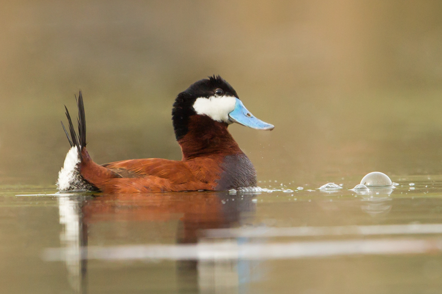
The restored wetland once again buffers the Sauk River from pollutants and helps preserve its water quality. The wetland also provides additional water storage on the landscape to prevent flooding, important in the face of the increasing heavy precipitation events that are now commonplace due to climate change.
Large sections of the Sauk River are listed as “impaired” by the Minnesota Pollution Control Agency (MPCA), including the stretch that flows over the protected property. Adding to the matrix of protected lands in the region as the Heurungs have done with their conservation easement helps preserve the health of the Sauk River and the greater watershed of around 667,200 acres of land where agriculture dominates.
Preserving and improving water quality in this region of the state has far-reaching implications. The Sauk feeds into the Mississippi River, the primary source of drinking water for the cities of Minneapolis and St. Paul, and a crucial waterway for millions more people to the south as well as migrating birds, fish, and other wildlife.
The Heurungs truly are heroes for future generations of Stearns County residents and area wildlife that will benefit from their generosity today.
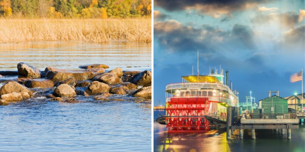
The Misi-ziibi (Mississippi) River & Tributaries
The Mississippi River is a crucial waterway and resource for reasons ranging from important wildlife habitat to drinking water to commerce. The headwaters and upper portion of the Mississippi River comprise a small but important segment of this Great River. Protecting and improving the health of the waters of the Mississippi starts here in Minnesota and includes tributaries like the Sauk River.
The impact and scope of the Mississippi River may be incalculable, but there are some data points that help put it into perspective:
- The Mississippi River is the second-longest river in North America, flowing 2,340 miles south from Omashkoozo-zaaga’igan (Lake Itasca) in Clearwater County, Minnesota to the Gulf of Mexico. It takes approximately three months for water to travel the entire length of the river.
- It releases over 4 million gallons of water into the Gulf of Mexico every second.
- The Mississippi’s watershed and many tributaries drains all or parts of 32 U.S. states and two Canadian provinces. The river either borders or passes through 10 states, including Minnesota, Wisconsin, Iowa, Illinois, Missouri, Kentucky, Tennessee, Arkansas, Mississippi and Louisiana.
- Indigenous people have lived along the river and its tributaries for thousands of years, leveraging the waters and surrounding landscape for hunting and gathering. Many Indigenous cultures also built urban and agricultural civilizations adjacent to the river, including mound earthworks that persist today. The Ojibwe name for the river is Misi-ziibi (Great River). Get Misi-ziibi pronunciation.
- Eighteen million people throughout the U.S. rely on the Mississippi River for drinking water, including nearly 1-million residents in St. Paul and Minneapolis.
- It supports around 25% of all North American fish species, about half of which live below St. Anthony Falls, which is the only major waterfall along the river.
- Nearly 40% of North America’s waterfowl and 60% of bird species in the U.S. use the Mississippi Flyway, traveling along the Mississippi River from breeding grounds in Canada and the northern U.S. to wintering grounds as far south as South America.
- In addition, around 241 species of fish, 50 mammal species, 37 species of mussels, and 45 amphibian species are found within the Mississippi River system.
- Around 505 million tons flows down the river each year. That equates to $80–$114 billion dollars of commerce.
- It’s possible to drive almost the entire length of the Mississippi River following the Great River Road.
Protected Property Photo Gallery
Click or tap on the photos to view full sized images of this beautiful protected property and related wildlife and habitats.


Article Contributors
Written by: Sarah Sullivan–Communications & Marketing Manager
Professional review by: Leah Hall–Conservation Program Manager
As Seen in the 2023 Spring Review
This property and landowners were featured in the Minnesota Land Trust’s 2023 Spring Review publication, focusing on the importance of protecting Minnesota’s clean and fresh water.
Signup to receive these beautiful publications directly to your mailbox.
Thank you for your continued support of habitat conservation, restoration, and nature engagement in Minnesota.
More from the Alexandria Moraine & Mississippi Corridor North
- Restoring a Landscape from the Past & Preserving it for the Future
 The Heurungs have protected over 70 acres of their property in Stearns County, mostly composed of forest and woodland, grassland, and wetlands, and 2,829 feet of shoreline that includes a portion of the Sauk River and a restored pond. Active stewards of their land since they acquired it in 2017, the family partnered with Stearns… Read more: Restoring a Landscape from the Past & Preserving it for the Future
 - Protecting 79-acres of Critical Waterfowl Habitat in North America’s Duck Factory
 Landowners Dave and Stephanie Sanderson have enjoyed their beautiful Otter Tail County property for many years, engaging in a variety of recreation activities including hunting, hiking, bird watching, and photography. In partnership with the Minnesota Land Trust, the Sandersons have generously donated a 79-acre easement, protecting the habitat, wildlife, and opportunity to recreate in perpetuity.… Read more: Protecting 79-acres of Critical Waterfowl Habitat in North America’s Duck Factory
 - A Ducky Partnership
 Minnesota is renowned for its ecosystem diversity; countless wildlife, plants and insects call it home. So, it may not be surprising to learn that Minnesota is also home to America’s “Duck Factory”, one of the most productive nesting areas for waterfowl in North America. The prairie pothole region, found in western Minnesota, is a landscape… Read more: A Ducky Partnership
Funding for the acquisition of this Easement has been provided by Minnesota’s Outdoor Heritage Fund as recommended by the Lessard-Sams Outdoor Heritage Council (“LSOHC”). Specifically, this Easement was funded through the Sauk River Watershed Habitat Protection and Restoration–Phase 2 program.