
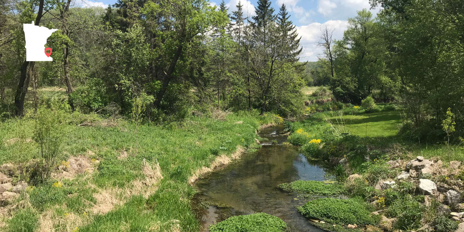
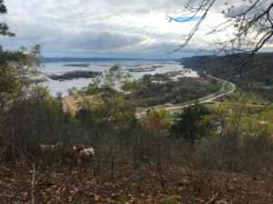
The Minnesota Land Trust has added 43.7 acres of permanently protected property near Winona, MN, in the Land Trust’s Southeast Blufflands priority conservation area. The protected property has a restored grassland with native plants including big bluestem, switchgrass, prairie cordgrass, lake sedge, woolgrass, tussock sedge, and bottlebrush sedge.
A deciduous forest comprised of eastern cottonwood, American basswood, box elder, and American elm follows the natural s-curve of the creek through the northern section of the property. And woodlands consisting of white oak, red oak, bur oak, shagbark hickory, black cherry, sugar maple, American elm, paper birch, and quaking aspen populate the southwest-facing bluff.
With 79.5% of the protected acreage forested, the property is estimated to sequester around 11 metric tons of carbon annually, the equivalent of approximately nine gas powered passenger vehicles driven for one year.
43.7 Acres Permanently Protected
- Forest: 34.7 acres
- Grassland: 8.2 acres
- Wetlands: .1 acre
- Water: .7 acres
- Shoreline: 2,810 feet
Wildlife Observed on the Property
- Coyote
- Wild turkey
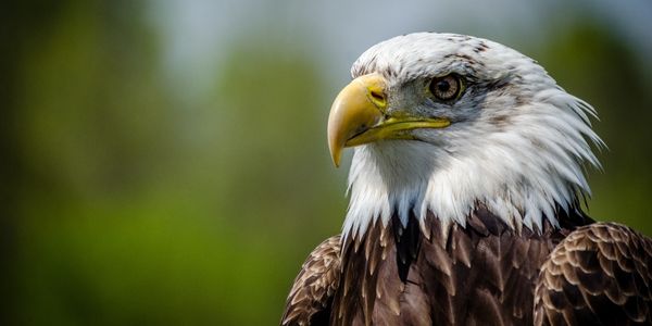
- Bald eagle
- Fisher
- Black bear
Elevation Helps Mitigate the Effect of Climate Change
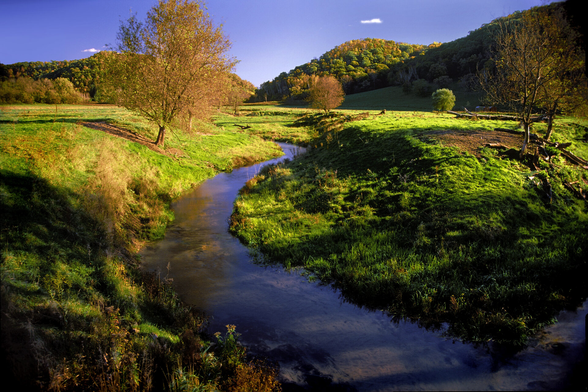
Besides the carbon storage, it’s the elevation change that is most notable about the landscape, according to program manager Mark van der Linden, “I think what’s fantastic about this property is that it protects the valley, all the way from the stream to the top of the bluff! The elevation gain is nearly 400 vertical feet, and the landowner has done extensive landscape restoration, including restoring an area of floodplain that used to be farmed to a grassland habitat.”
This region of Minnesota is part of the Driftless area which extends into portions of Wisconsin, Iowa and Illinois. With dramatic elevation changes ranging from 603 to 1,719 feet, the area is known for steep hills, forested ridges, and deep river valleys sheltering spring fed cold-water trout streams. Ecologically, the region’s flora and fauna are more reminiscent of those found in the Great Lakes region than those of the rest of the Midwest and Central Plains.
On the Move…
Studies show that North American plants and animals are moving on average 11 miles north and 36 feet higher in elevation each decade in response to climate change (nature.org).
The elevation and karst topography in the region create different types of habitats in close proximity to one another and even numerous microhabitats. Preserving and restoring areas with larger elevation change supports climate change resiliency because it protects a greater number of habitats and “refugia,” spaces that provide refuge for species moving from changing habitats that no longer support them.
Conserve More of the Southeast Blufflands
Your gift helps amplify our protection and restoration impact across Minnesota.
Want to protect your property in Houston, Fillmore, Winona, Olmstead, Wabasha, or Goodhue County? Learn more about protection opportunities in this region.
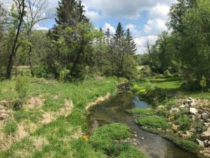
Protecting Cedar Creek & Trout Fishing
Boasting 2,810 feet of undeveloped shoreline, the protected property helps maintain the ecological integrity of the Cedar Creek sub watershed (part of the Mississippi River-Winona watershed) and provides near-shore aquatic habitat for many plants and animals.
Cedar Valley Creek is a perennially flowing cold-water state-designated trout stream that flows through the property eventually draining into the Mississippi River. The stream supports fish species including brown trout, white sucker, longnose dace, blacknose dace, bullhead minnow, creek chub, central mudminnow, and brook stickleback.
Overall, this property is a climate-resilient site according to the Nature Conservancy’s Resilient Land Mapping Tool. It has a relatively high capacity to maintain species diversity and ecological function as the climate changes due to relatively few human-created barriers and its high variable topography, elevations, and hydrology.

Protected Property Photo Gallery
Click or tap on the photos to view full sized images of this beautiful, protected property and related wildlife and habitats.


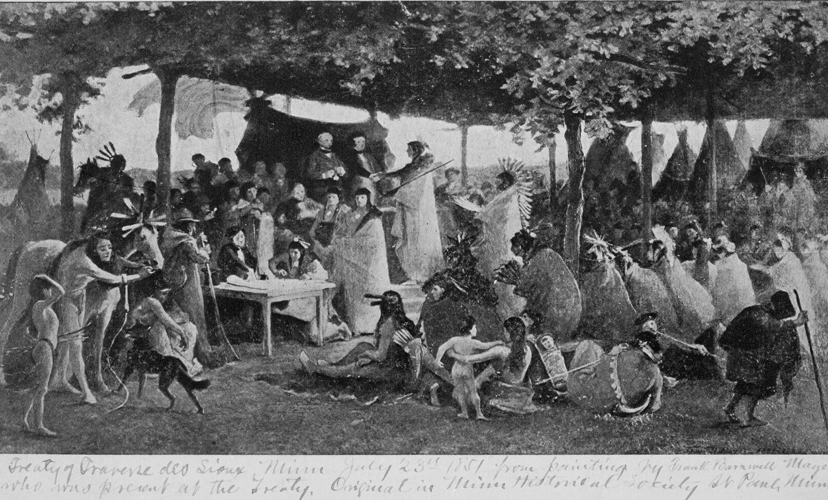
The Dakota People & The Treaty of Traverse des Sioux
Indigenous people have lived in this region from prehistoric times to the present day. It is home to the Dakota, more specifically the Wahpeton and Wahpekute bands, who hunted, fished, gathered, and stewarded the land. Native Americans recognized the rich natural resources in the area and valued the river valley for its abundant fishing and wildlife, protective hardwood forests, and temperate climate.
The uplands supported herds of bison, deer, rabbits, and other wildlife that provided both food and hides, and the Mississippi River and its tributaries provided fresh water, fish, and reed grasses for weaving. The rivers allowed for navigation and the bluffs gave vantage points for communications and keeping watch.
The signing of the Treaty of Traverse des Sioux in 1851 between the U.S. government and the Dakota opened around 24 million acres of land primarily in southern and western Minnesota to European settlement. The original agreement called for a reservation on the south and north banks of the Minnesota River and payment of $1,665,000 in cash and annuities to the bands being displaced, the equivalent of 7.5 cents per acre of land. The promised reservation never materialized and $400,000 of the annuity payment was diverted to fur traders. Learn more about the Treaty of Traverse des Sioux.
The arrival of European settlers in southern Minnesota in the late 1800s, including the proliferation of agriculture, logging and the timber industries, dramatically transformed the landscape.
Visit the Southeast Blufflands
Fish Cedar Creek at the Cedar Creek Aquatic Management Area (AMA) or visit one of the many state parks in the region to take in panoramic scenic beauty at elevation and experience the unique ecological habitats that make the region so unique.
- Great River Bluffs State Park, Winona MN
- Whitewater State Park, Altura MN
- Carley State Park, Altura MN
- John A. Latsch State Park, Altura MN
- Beaver Creek Valley State Park, Caledonia MN
- Frontenac State Park, Frontenac MN
- Forestville/Mystery Cave State Park, Preston MN
More from the Southeast Blufflands
- Protecting & Connecting the Southeast Blufflands Near Brownsville, MN
 Located atop a beautiful and steep forested bluff overlooking Brownsville, MN, this recently protected property—a generous full donation of the conservation easement—is in the Minnesota Land Trust’s Southeast Blufflands priority conservation area. Though small in acreage, the quality of the protected property, due in part to the landowners’ diligent restoration efforts, has an outsized impact… Read more: Protecting & Connecting the Southeast Blufflands Near Brownsville, MN
 - The Elevation Effect—Climate Resiliency in Southeast Minnesota
 The Minnesota Land Trust has added 43.7 acres of permanently protected property near Winona, MN, in the Land Trust’s Southeast Blufflands priority conservation area. The protected property has a restored grassland with native plants including big bluestem, switchgrass, prairie cordgrass, lake sedge, woolgrass, tussock sedge, and bottlebrush sedge. A deciduous forest comprised of eastern cottonwood,… Read more: The Elevation Effect—Climate Resiliency in Southeast Minnesota
 - Goats Help Restore Resilient Lands in Southeast Minnesota
 Goats are known for all kinds of antics, including yelling, fainting, and of course, climbing into everything from delivery trucks to trees. In Southeastern Minnesota, on a Winona County property permanently protected by a Minnesota Land conservation easement, these functionally majestic animals are being leveraged for another one of their innate talents-their ability to destroy… Read more: Goats Help Restore Resilient Lands in Southeast Minnesota
Funding for the acquisition of the Easement has been provided by Minnesota’s Outdoor Heritage Fund as recommended by the Lessard-Sams Outdoor Heritage Council (LSOHC). Specifically, the Easement was funded through the Southeast Minnesota Protection and Restoration Phase 8 program.